
OLD SANTEE CANAL PARK
OLD SANTEE CANAL PARK
Trail Maps
Trail Maps
2012
2012
Challenge
Challenge
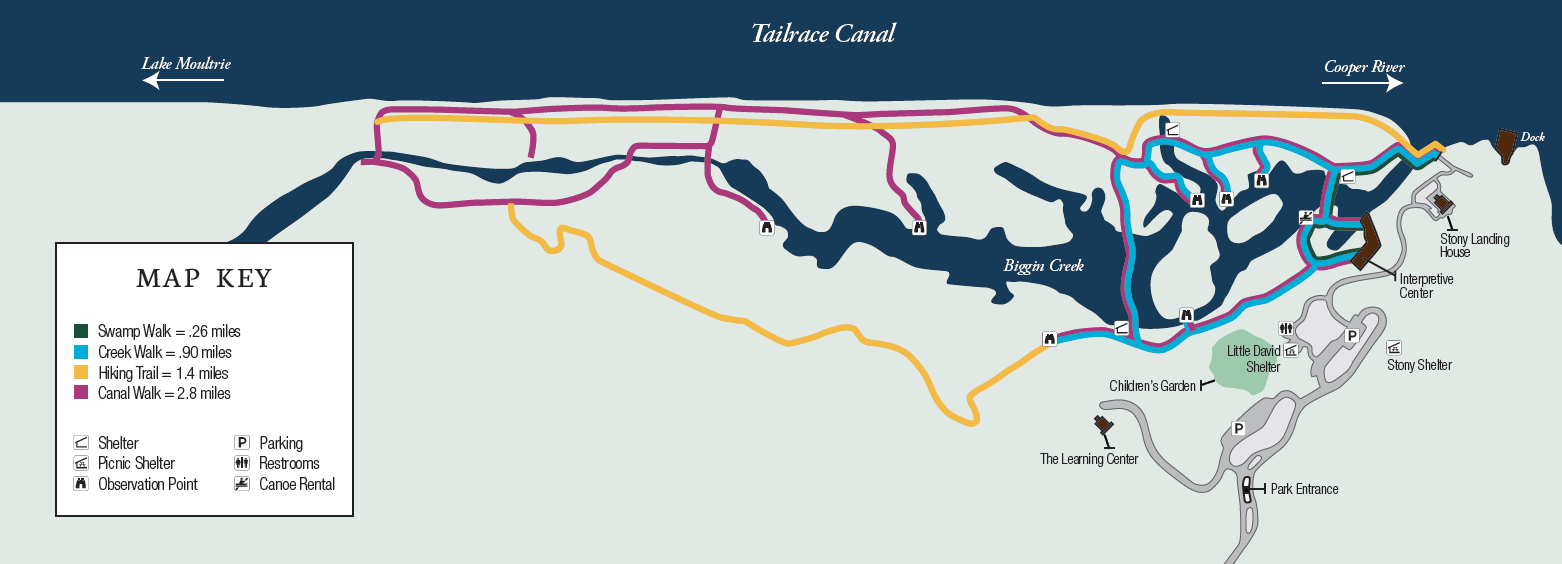
Simplify the trail map designs for easier comprehension and standardized iconography. At the time, none of the trail maps were oriented properly based on their location in the park and in conjunction with the Tailrace Canal.
Value
The new map (at the time) was illustrated for in-house production printing directly to durable, outdoor vinyl, adhered to aluminum signage and laminated with a protective layer.
Each sign was made unique for its location and installed along the walkway. The updated maps were then used throughout all Park literature and handouts.
Completed Design Examples
Completed Design Examples
Campaigns
Campaigns
Print
Print
Signage
Signage